
Kolkata - The Marine & Coastal Survey Division of the Geological Survey of India, the 171 year old premier geo-scientific research organisation, has been actively involved in exploring the oceans around India. Their work mainly revolves around collection of surface sediment samples and spot bathymetric data.
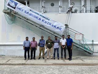
Shri. R. S. Garkhal, Director General, Geological Survey of India (DG, GSI) visited the GSI Research Vessel Samudra Ratnakar from 23rd to 24th October, 2021 to review the activities and operations of the Marine & Coastal Survey Division (MCSD). He was accompanied by officers from PSS-P&M Division and MCSD, CHQ. They boarded the vessel from Port Blair on 23rd October and sailed to Barren Island.
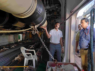
Interpretations of surface and subsurface profile and its application for generating various thematic maps were also demonstrated. The operations of various engine, deck and navigational equipment and machineries were also shown by the officers and crew members of the Shipping Corporation of India (SCI) and the support team from M/s Norinco and Seapol. Shri. Garkhal also sought information about overall ship management to overcome various natural calamities and its effect on scientific data acquisition while they were sailing.
The trip successfully concluded at Port Blair on 24th October, 2021.


0 Comments